
Walking Routes
Walks in Callander and the Trossachs
Easy
Callander Meadows: 1.25 miles
This wheelchair accessible circuit is the perfect way to spend 30 minutes admiring the river Teith and the surrounding meadows.
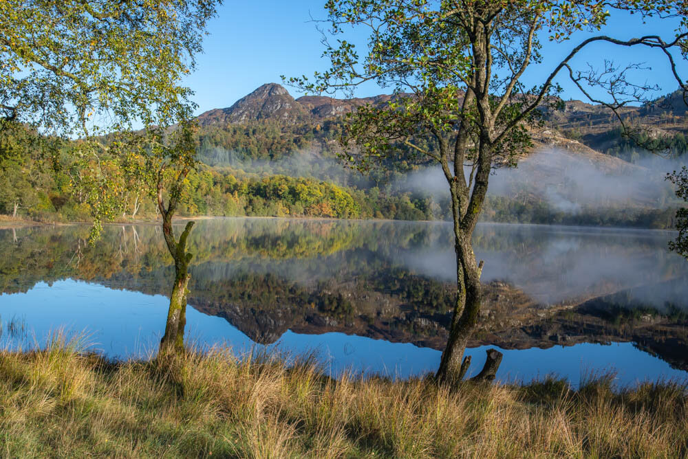
Glacier Trail: 3 miles
A three-mile gentle walk which highlights the lasting geological legacy following the retreat of the glaciers about 12,000 years ago. The walk takes you along uneven paths and can be muddy Allow 90 minutes
Heritage Trail 1-2 miles
A signposted circuit of Callander explains how the town evolved after the Jacobite Rebellion. Interpretation boards draw your attention to the changing architecture in the town, as the Georgian era gave way to the Victorian age, when Callander experienced its first influx of tourists, eager to experience the romance of the Highlands. The walk is mainly on pavements and firm-surfaced paths. Allow 30-60 minutes
Moderate
The Three Bridges: 4.5 miles
This 4.5-mile walk will take you from the town centre into Coilhallan Wood, across to Dunmore Fort and Samson’s Stone through the Roman Fort and then along by Little Leny Burial Ground (the ancestral burial place of the Clan Buchanan). Allow 2.5 hours. The walk takes you along surfaced and forest roads and paths. Allow 2.5 hours
Bracklinn Falls Circuit: 3.5 miles
Starting at the Bracklinn Road carpark the route takes in woodlands, fields and, of course, the mighty Bracklinn Falls. There are some fairly steep climbs on this 3.5-mile walk and the route will take you onto well compacted paths. Allow 2.5 hours.
Lower Woods : 2 miles
Starting at the Crags car park, this route takes the path through the wildlife-rich woodlands above Callander. The route becomes a little steeper at the midway point and allows a clear view of the Menteith Hills. A steep downhill section leads to the west of the town where you can return to the car park; either via the Main Street or by following Ancaster Road and then Bracklinn Road. Allow 1 hour
Strenuous
Callander Crags: 2.5 miles
This relatively short but challenging walk takes you from the Callander Crags car park up the steeply climbing forest path until you reach the top of the Crags. For this vantage point, on a clear day, you will see Loch Venachar, Ben Ledi and the Highland Boundary Fault. You can take a short detour at the top to visit the Queen’s Jubilee Cairn which was originally built in 1897 and restored to commemorate diamond jubilee of Queen Elizabeth II in 2012. Allow 90 minutes-2 hours.
Longer walks
The Great Trossachs Path
The Great Trossachs Path allows walkers of all abilities to experience the stunning landscape in and around Callander, and beyond. Options vary between short, 90-minute walks of less than 3 miles, Medium length (3-8 mile) walks of varying difficulty, lasting up to 4 hours or day-long treks some of which will involve steeply climbing hill paths. The most dedicated walkers can follow the circular, 30-mile, route. Details of which can be found here.
Wheelchair users can take the Brenachoile Trail from the Trossachs Pier at Loch Katrine. Allow 2.5 – 3 hours for the round trip and power chair users can try the walk from Callander to Samson’s Stone along the National Cycle Route NCN7 allowing 3 hours for the round trip.
Hill walking
Ben Ledi
Situated on the southern edge of the highlands, Ben Ledi dominates the skyline to the west of Callander. Popular with hillwalkers, Ben Ledi is 879m (2884 ft) high and is an exhilarating climb up the recently upgraded path. You should allow 4-6 hours for the round trip and should bring hillwalking gear. Once at the summit, you will be rewarded with spectacular views across the Trossachs and south eastern Highlands.
Ben Ledi lies about 6.4km (4miles) north of Callander (along the A84) and can be accessed from the Stank car park which can be found if you follow the signs for Strathyre Forest Cabins.
Ben A’an
Ben A’an, known locally as the mountain in miniature, is one of the easier climbs in the Trossachs. The 4km walk along the recently rebuilt path is steep in parts but will take you through forests and open moorlands to the summit where the view extends across Loch Katrine. Allow 2-4 hours for the round trip.
Ben A’nn lies 8.7 miles from Callander be accessed from the car park on the A821 at the start of the climb.
Ben Gullipen
With a summit at just 414m above sea level the gentle climb will reward you with views, across the Trossachs (to the west) taking in Loch Venachar, Ben Ledi, Ben Vorlich and Stuc a’Chroin. To the south you can see the Wallace Memorial and over to Stirling Castle. Sitting on an open parallel ridge, Ben Gullipen was formed as a result of geological activity along the Highland Boundary Fault marking the transition between the Highlands and the Lowlands.
Ben Gullipen can be accessed, by road, from the car park on the Mollands Road (A81) 3.5 miles from Callander town centre. By foot or bike Ben Gullipen can be accessed from the National Cycle route 7, along the Invertrossachs Road. Allow 2-3 hours for the round trip
Ben Venue
You will find Ben Venue approximately 2km south of the pier at the southern end of Loch Katrine. Another mountain in miniature, Ben Venue is 545 meters high and is a popular but challenging climb, taking in boggy and rocky ground along the ascent. The ben can be accessed from the car park at the head of Loch Achray on the A821 between Brig O’Turk and Aberfoyle. The 8.75-mile return walk will take 5-6 hours.
Ben Vorlich and Stuc a Chroin
These are the closest Munros to Callander and can be climbed in one circular route or tackled individually. Although from a distance they appear to be identical they are very different when climbing. Ben Vorlich is a moderate, and popular, climb but Stuc a Chrion should only be tackled by those who have some climbing experience and are fit enough to tackle the steep and potentially hazardous climb. The route to Ben Vorlich starts at Ardvorlich House on the southern banks of Loch Earn. Allow 4-6 hours for the round trip.
Stuc a Chroin can be climbed as a continuation of the Ben Vorlich route or can be accessed from the car park on the banks of Loch Lubnaig at Ardchullerie Mhor. Allow 8-10 hours for both climbs or 5-7 hours to climb Stuc a Chroin
Ben Lawers
The 10th highest mountain in Scotland at 1,214m (3,984ft) Ben Lawers gives its name to the wider National Nature Reserve. The reserve is owned and managed by the National Trust for Scotland (NTS) and stretches for around 4,500 hectares and includes a further 6 other Munros within its boundary. NTS have laid out a series of shorter walks within the reserve and details can be found here.
The climb to the summit of Ben Lawers will take you through areas of rare alpine plants (which should not be disturbed) and will possibly allow you glimpses of ptarmigan, red deer, skylarks and black grouse. At the summit you will be rewarded with stunning views over Loch Tay over to the east coast (on a clear day).
To get to there, take the A84, north, to Lochearnhead, then take the A85 through to Lix Toll where you turn onto the A827. Follow the road, through Killin, for 3 miles until you reach the signpost for Ben Lawers and Bridge of Balgie (on the left) then follow that road until you reach the Ben Lawers Car Park. Allow 3-6 hours for the round climb.
Download Maps
Click below to download PDF maps and guides to popular Callander walks.